
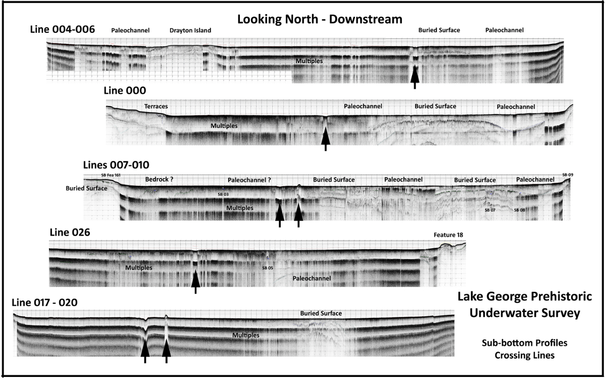
This ARCO-OP sponsored project builds on previous work completed in Lake George by examining and dating old sediments of likely late Paleoindian age (about 12,000-11,500 years ago) and probable Mount Taylor age (about 7,000-6,000 years ago) in Lake George. From our survey and analysis of the 2017 data we now have a better understanding of the broad outlines of the Lake’s sub-bottom morphology.
It is clear that the present configuration of the lake bottom – flat with uniform depth and lots of lost crab traps – is relatively recent, probably created in the last 7,000-8,000 years when the lake basin began to flood. We also know the lake basin was occupied by people starting at least 12,000 years ago. We also know that large extinct animals – mammoths, mastodons, camels, horses – roamed the basin earlier than that. One of our major research questions is trying to understand what this pre-flooded landscape looked like. Reconstructing this paleo-landscape will help us better understand how early Floridians used the basin, and possibly enable us to identify well-preserved early sites.
The one known early site on the basin edge was probably a large camp (8PU1407) occupied by Paleoindians who made a distinctive kind of knife or spear-point called a Suwannee point. Although the site was extensively collected and is essentially gone, we want to determine whether more of the evidence for early people is buried in the area. In addition, we want to better understand whether the late Holocene Mount Taylor occupation at Silver Glen has earlier, now-submerged components. Finally, we need additional ground penetrating radar (GPR) data to remotely sense areas of the lake that were obscured in the seismic record because of organic sediment cover.
These archaeological sites are protected by law and 8PU1470 in particular is watched by nearby locals. It is illegal to collect artifacts on them or disturb them in any way without research plan and DHR permit.
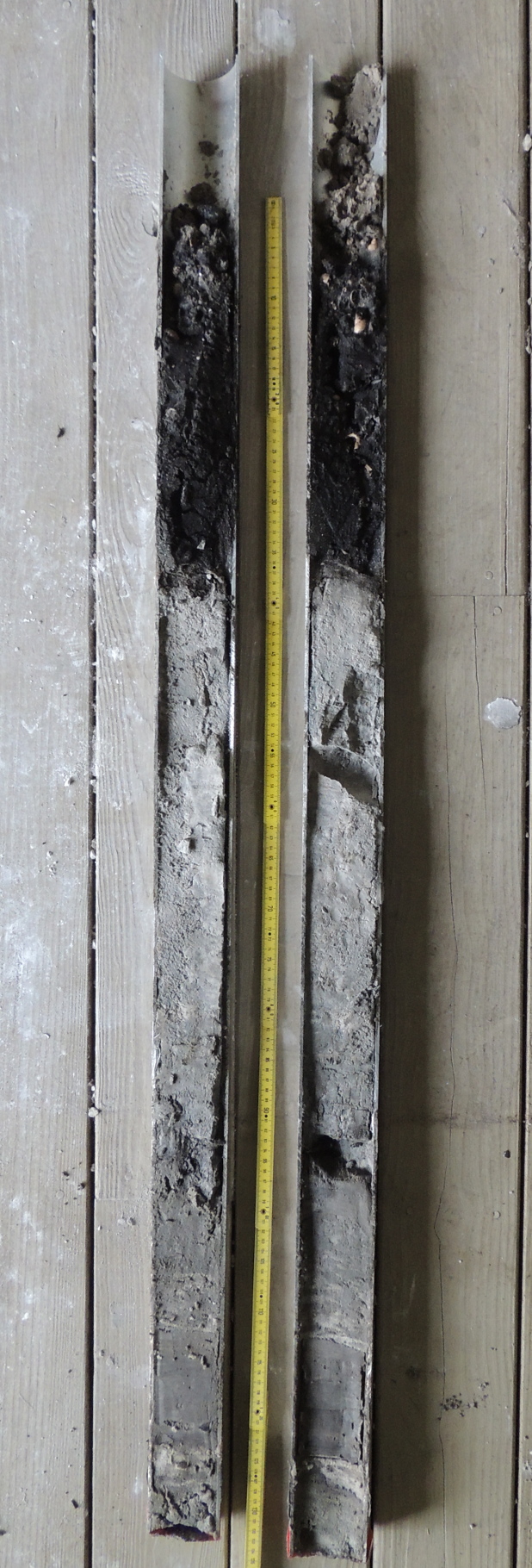
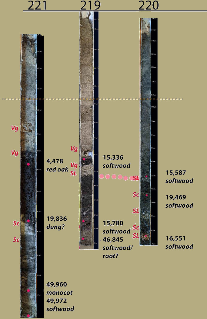
In this next phase of our investigation, we drove four cores into specific target areas identified in sub-bottom reflectors detected in Phase I. This allows us to better interpret the seismic data and reconstruct the sedimentary history of the Lake, and took samples for radiocarbon dates to provide a chronology for their formation and the in-filling of the lake. The report of these activities is Thulman 2020